Municipal authorities of two major islands in Japan's Seto Inland Sea have prepared a new road map for tourists' convenience.
The map of Shodo Island and Teshima Island in the western Japan prefecture of Kagawa shows tourist spots and major roads on the islands and includes distances, travel time by car and ferry timetables.
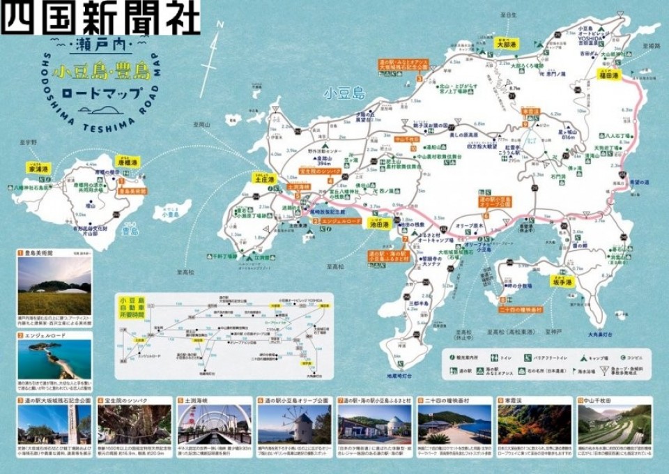
The local authorities have printed 120,000 copies of the map for distribution at town offices and tourist destinations including the Olive Park on Shodo Island and Teshima Art Museum.
Locations of toilets, convenience stores and tourist information centers are indicated by icons, while a QR code is shown on the ferry timetables for easy access to the ferry operator's website.
Related coverage:
Year of Tiger coins available for preorder at west Japan banks
Japan's largest pumpkin for the year weighs 394 kg
"Double diamond" viewing under way at Japan's other Mt. Fuji


